
Pubs in the nineteenth century

The Red Lion, no. 7 Walmgate. [All photographs are by the author. Click on the images to enlarge them.]
The nineteenth century was a boom time for pubs. Nationally, there were many ancient inns or hostelries where ale and beer might be drunk, and latterly some commercial breweries supplying them, but a rising urban population encouraged new outlets. In 1830 the brewing of beer for sale in domestic houses was permitted by the Beerhouse Act. This act was passed in the hope that the consumption of spirits would be reduced by an increase in the availability of beer (memories of Hogarth’s horrific Gin Lane and the slightly more preferable Beer Street). The Act allowed a licence to be granted where the house was of an annual rateable value greater than £10. Any qualifying house-holder might get a licence, but there was no test of his or her suitability, and more legislation necessarily followed throughout the century. This type of licence meant that many of the ‘public houses’ of Victorian times looked just like private houses except for the compulsory signboard over the door. With a wage-earning population that was too busy and too poor to brew for itself, but might have a little spare money, the number of licensed premises increased. This essay describes the conditions in one section of Walmgate, York, and is illustrated with some of the remaining evidence of nineteenth-century use.
The adverse social effects of the proliferation of pubs were complex, and slow to be recognised, like many social ills. The following excerpt from Elizabeth Gaskell’s novel North and South (1854-5) describes, from the author’s own experience of visiting the poor in Manchester, something of the background of such an area. It brings vividly to life the conditions in fictional Milton-Northern, a cotton town in Darkshire, in the middle of the nineteenth century as a strike was in the air. The speaker is Bessy, the terminally-ill daughter of a weaver who is one of the leaders of the strike:
But what win ye have? There are days wi’ you, as wi’ other folk, I suppose, when yo’ get up and go through th’ hours, just longing for a bit of a change – a bit of a fillip, as it were. I know I ha’ gone and bought a four-pounder out o’ another baker’s shop to common on such days, just because I sickened at the thought of going on for ever wi’ the same sight in my eyes, and the same sound in my ears, and the same taste in’ my mouth, and the same thought (or no thought, for that matter) in my head, day after day, for ever. I’ve longed for to be a man to go spreeing, even if it were only a tramp to some new place in search o’ work. And father – all men – have it stronger in ‘em than me to get tired o’ sameness and work for ever. And what is ‘em to do? It’s little blame to them if they do go into th’ gin-shop for to make their blood flow quicker, and more lively, and see things they never see at no other time – pictures, and looking-glass, and such like. But father never was a drunkard, though maybe, he’s got worse for drink, now and then. Only yo’ see,’ and now her voice took a mournful, pleading tone, ‘at times o’ strike there’s much to knock a man down, for all they start so hopefully; and where’s the comfort to come fro’? He’ll get angry and mad – they all do – and then they get tired out wi’ being angry and mad, and maybe ha’ done things in their passion they’d be glad to forget. Bless yo’r sweet pitiful face! but yo’ dunnot know what a strike is yet. [Ch. 17]
Pubs in nineteenth- and early twentieth-century York

5, 7 and 9 Walmgate, York: The Black Horse, Red Lion and Three Cups seen (left to right) from Foss Bridge.
Looking from Foss Bridge, three former or actual pubs can be seen, remarkably close together, with the 1912 street called Merchantgate between them. The drapers shop, on the extreme right edge of the image, had been succeeded by F. R. Stubbs, ironmongers, and now by a fish restaurant. The present Citylets, on the right, occupies the former Three Cups Inn at no. 5 Walmgate, but gives its address as 8 Foss Bridge House. In 1906 the Three Cups was said to be one of the worst six public houses in York (Murray 223), and it was closed the next year. On the left, the Black Horse, no. 9 Walmgate, now The Corner Grill House, closed in 1910.
The long narrow building plots account for the Red Lion (see also top left) being set so far back off the street. It is numbered as 7 Walmgate in the Heritage Listing, though its on-line advert uses the address, 2 Merchantgate. This short street at right angles to Walmgate cut away the old pig market, coach builder’s workshops, etc., in 1912.
Seebohm Rowntree and Poverty: a study of town life

In 1902, the Chief Constable’s reports on licenced premises, preserved in the City of York Archives, show that in most establishments - even the larger ones – standards were not high, for example, customers commonly shared a toilet with the family, but, after all, pubs were for the cheap end of the drinks market; gentlemen had their clubs, like the (former) Yorkshire Club on the bank of the Ouse, or drank at home. A peak in the number of pubs in York occurred around the end of the century, coincident with the publication of the book Poverty: a study of town life by B. Seebohm Rowntree (1901), following another by his father Joseph Rowntree II, with Arthur Sherwell, The Temperance Problem and Social Reform (1899).
Seebohm inherited from his father and grandfather a statistical acumen which he put to good effect in Poverty; later volumes, Poverty and Progress (1941) and Poverty and the Welfare State (1951), were inevitably less personally experiential and, while of considerable interest, lack the pioneering (and devastating) significance of the initial survey. By his firm, statistically well-supported, demonstration of the causal link between poverty and the low wages paid to working men, and the insecurity of their employment, he was able to challenge the general assumption that poverty was merely the result of drink and fecklessness. ['Benjamin Seebohm Rowntree 1871-1954']


Part of Seebohm Rowntree’s 1901 map of Licensed Houses in York, showing the area being discussed, together with the key. Source: Poverty, Map and Key.
The living conditions of ‘the wage-earning classes’ which Seebohm Rowntree described are already recognisable in Gaskell’s fiction. But he was presenting undeniable facts, meticulously describing conditions in the poorest neighbourhoods using a wide range of statistics and comparisons; he demonstrated that hundreds of families in York had incomes which were ‘totally inadequate to maintain them, even in a state of merely physical efficiency… this deficiency is met partly by private charity and partly by starvation’ (40-1). He calculated a standard minimum income for people to live for the maintenance of merely ‘physical efficiency,’ as he put it, and showed that many people who live in poverty couldn’t easily help their situation.
In a Supplementary Chapter, he considered the immediate causes of the poverty that affected further families who had an income above his minimum level (142), these causes were drink, betting and gambling, along with ‘ignorant or careless housekeeping and other improvident expenditure, the latter often induced by irregularity of income’. Drink is first on the list (302-326). His ‘drink map of York’ (308) plots the licensed premises onto four categories of urban land-use (what we might now call the CBD or central business district, and three social classes of housing). The poorest districts of York, the most easily identifiable and largest of which is the Walmgate area (confined between the river Foss and the city wall, with Walmgate its main street) had by far the greatest density of pubs. Rowntree wondered if this density might be due to York having been a centre of the stage-coach system, but was unsure about further reasons. It may well owe something to the Beerhouse Act of 1830, as well to the long history of Walmgate as a main road into the city: what was once a favoured address had become an industrial slum.
Walmgate then and now


Left: Morrell Cottages, down the yard between nos. 15 and 17 Walmgate. Right: The entry to Mawson’s court.
If ‘drinking’ has moved up-market, so has housing. In the former Britannia Yard, between the Red Cross charity shop and Kona Coffee (nos. 15 and 17), there are now the two Morrell Cottages, of two bedrooms each and built with reclaimed bricks. The owner, York Civic Trust says:
The land on which they are situated was once known as Britannia Yard, part of the Britannia Inn which was situated where 17 Walmgate is now. It was first mentioned in 1818 and again in 1820 when it had changed its name to Britannia Coffee House. In the nineteenth century Walmgate was one of the worst disease-ridden slums in the city. The area had become increasingly overcrowded and unhealthy when hundreds of Irish families immigrated to York, after the devastating Irish potato famine which took place between the years 1846 and 1851. It is recorded that sixteen cottages in Britannia Yard housed fifteen Irish families and one English family; in total there were over one hundred and seventy one Irish people in this one yard.


Left: 27 Walmgate, The Full Moon, now Botanic, house plants in profusion, with Barleycorn Yard between it and no. 25. Right: Entry to Nelson’s Yard, between nos 29 and 31 Walmgate.
27 or 29 The Full Moon, formerly The Barleycorn, was rebuilt shortly before 1902, and did not close till 1939. Occupying nos. 29A and 29B at present are a dry-cleaning and alteration business, and a bubble-tea bar. A little further on is another opening with a recent housing development behind known as Nelson’s Yard.


Left to right: (a) 31 Walmgate, Nelson’s House. (b) 31 Walmgate, Nelson’s House, detail of glazed brickwork. (c) 37 Walmgate, detail of doorway.
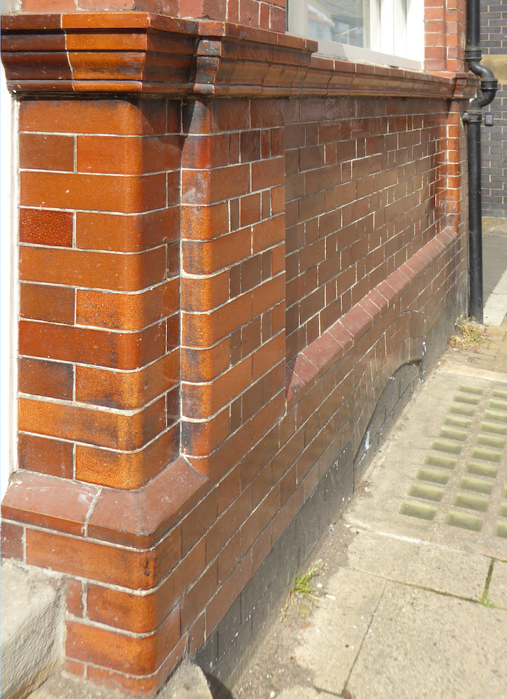
31 Nelson's House was once the site of the Lord Nelson Inn, but this is not the same building as listed in 1885;it was rebuilt c. 1902, and closed in 1981. It has glazed bricks on the ground floor frontage in the manner of a pub.
By the end of the nineteenth century the Walmgate area had much densely-populated terrace housing: Rowntree gives a population of 4919 in this area. There were about 30 pubs, most of them on the main street; they were closest together in one short stretch between Foss Bridge and the churchyard of St Denys. In a distance of 150 metres, and on one side of the street only, there are eight inns named in the 1885 directory of York: see the list below. By the time Seebohm Rowntree’s survey was published in 1901, pubs were being closed by the licensing authority as opportunity occurred (because they were insanitary, disorderly, or considered just too numerous), so his map shows only seven.
List of businesses, 1885 directory
The York directory of 1885 lists the following businesses operating in this part of Walmgate, beginning at Foss Bridge, nearest the city centre. The pubs discussed above, with locations still remembered, are given on italics.
1 and 3 Walmgate, Foss Bridge House (1878), W. J. Whitehead and Co, general drapers
The Three Cups Inn [here was the pig market; also the un-numbered premises of a coach builder, a timber and iron merchant, and a second carriage builder - this one female]
7 The Red Lion Inn
9 Joseph Robinson, a horse breaker, and The Black Horse Inn
11 a grocer, baker and confectioner [here is Slaters Court]
13 a watchmaker and jeweller
15 a tinner and ironmonger [here is Britannia Yard]
17 The Britannia Inn
19 a baker and provision dealer
21 a saddler [here is Duke of York passage]
23 The Duke of York inn [Here is Weatherill’s Yard]
25 a saddler
27 a fishmonger [here is Barleycorn Yard]
29 The Moon Inn, or Full Moon
31 Lord Nelson Inn
33 a boot nail dealer [here is Lord Nelson Yard, also saw-mills]
35 a general shop
37 City Arms Inn, familiarly known as The Five Lions, which appear on the cross on the coat of arms of the City of York. There were several pubs in Walmgate with this popular sign [here is Dennis Street]
St Dennis church
Note: In Viking-age Jorvik (York), as in many medieval towns, old plot boundaries have a narrow frontage on the street but a long extension to rear. These elongated plots, just wide enough for an entry for carts into a yard, provided space at the back for multiple small workshops and other businesses, even additional living space (eventually providing the notorious slums in Victorian courts or yards). Some of the numbering has slightly changed, buildings have been rebuilt, or perhaps there were mistakes in the Directory, but even so the sequence along the street is still identifiable by evidence such as yard names or the use of glazed bricks on the ground floor - these were favoured for licensed houses in the early twentieth century. Only one pub of the eight is still a pub, though two former pubs are now licensed restaurants and two other businesses have become so; three sell non-intoxicating drinks, and one is a takeaway seeking a licence.
Links to related material
- Victorian and Edwardian Public Houses
- North and South by Elizabeth Cleghorn Gaskell (1810-65)
- The Price of Bread: Poverty, Purchasing Power, and The Victorian Laborer's Standard of Living
- Contrast of the Industrial North and Rural South
- Instead of the Pub: Temperance Billiard Halls
Bibliography
1885 Directory, Leicester University archive.
Benjamin Seebohm Rowntree 1871-1954. Rowntree Society. Web. 9 February 2022.
Chief Constable’s report, 1902. York City Archives 258.
Murray, Hugh. A Directory of York Pubs, 1455-2003. York: Bullivant, 1988.
Rowntree, B. Seebohm. Poverty, a Study of Town Life. Centennial edition by The Policy Press for the Joseph Rowntree Charitable Trust, 2002. Reproducing the original 1901 publication by Macmillan and Co. London (the 1901 edition is downloadable from the Internet Archive, here.
Created 10 February 2022