
Thanks to Ian Drake, Keeper of the Evelyn Collection, YAYAS (Yorkshire Architectural and York Archaeological Society) for allowing us to reproduce the historic photographs here. None of these should be reproduced without written permission. Please see the bibliography for the link to the collection. The recent photographs were taken by the author, and may be used without prior permission for any scholarly or educational purpose as long as you (1) credit the photographer and (2) link your document to this URL in a web document or cite the Victorian Web in a print one. [Click on the images to enlarge them.]
Before redevelopment
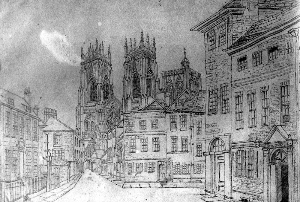

Left: Little Blake Street, or Lop Lane. Right: Plan for the new road. Courtesy of YAYAS Evelyn Collection; not to reproduced without written permission (see link in bibliography).
The historic drawing on the left above shows how Little Blake Street or Lop Lane once provided an approach to the west front of the Minster from the ferry over the Ouse. The street runs from the Red House to a gate into the precinct. The new plan, as seen on the right, was for a road to join the new Lendal Bridge to the Minster.
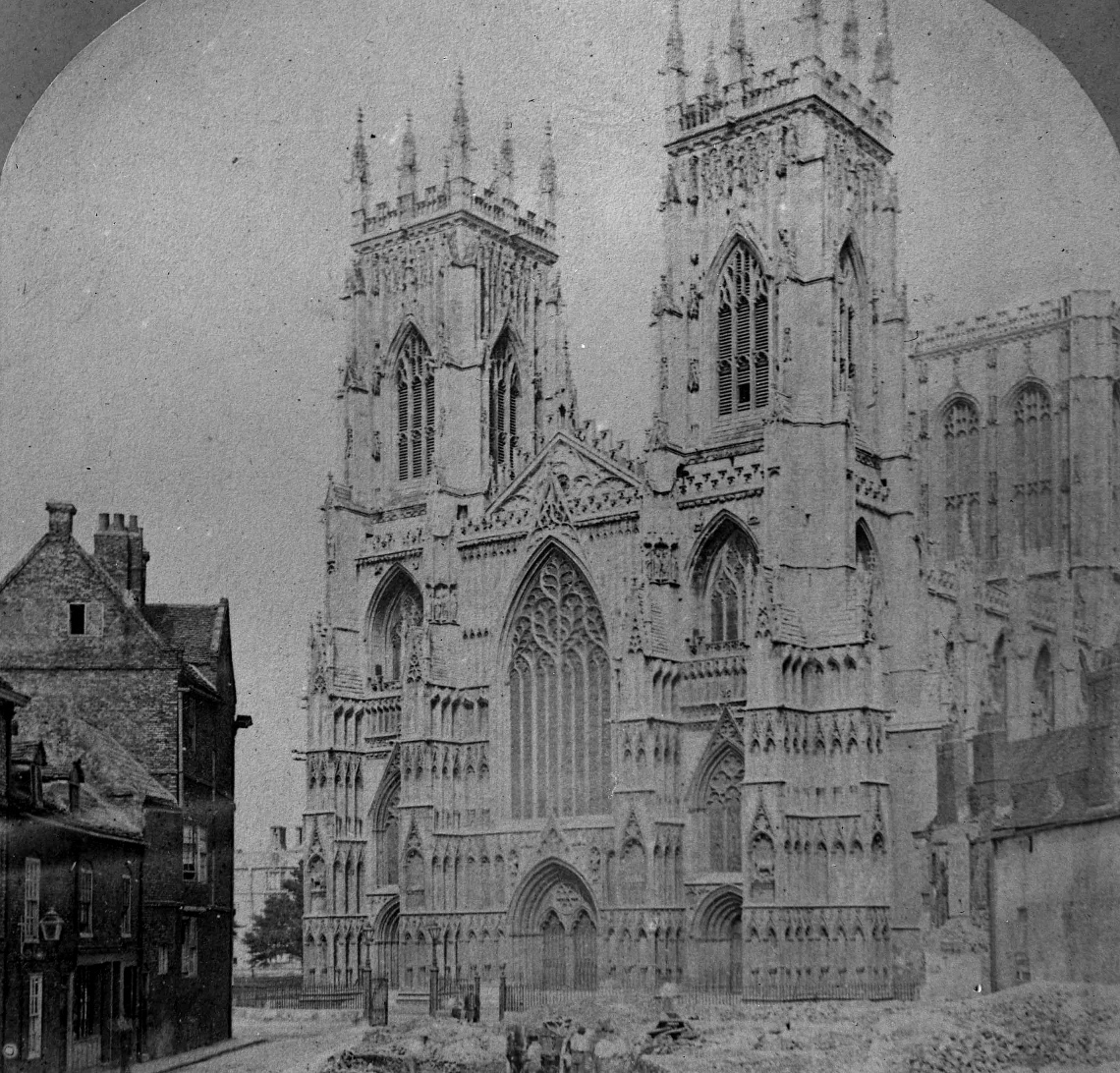

Right: View of demolitions in progress on south-east side, with earlier buildings still standing on the north-west side. Left: Closer view of the site. Courtesy of YAYAS Evelyn Collection; not to reproduced without written permission (see link in bibliography).
The new Duncombe Place
Duncombe Place was a wide new road laid out in 1859-64, stimulated by the construction of Lendal Bridge (1860-3). It replaced the narrow Little Blake Street (earlier known as Lop Lane) which ran up to one of the gates into the Minster precinct. This stone arched gate was removed and replaced by railings.
Initially, the buildings on the north-west side were left untouched. Although the Carr-Brierley archives list the new houses by the Atkinson brothers (at nos. 1-3) with a date of 1865, they may not have been started till the 1870s. Adjacent 18th-century houses (nos. 4-6) were retained; next to those was an entrance to the Theatre Royal and somewhere here, a French polisher (the only tradesman on the Place in the 1885 directory). The "Catholic Chapel" shown on the plan was rebuilt in 1862-64 as the Roman Catholic pro-cathedral, St Wilfrid’s; the Red House (1702-4) on the corner of St Leonard’s Place (itself a new road, laid out in 1831) is seen at the left edge of the old The Red House is seen on the left edge of the old drawing (top row, left) and in the first colour photograph below. The ground was cleared first on the south-east side, as seen in the third old photograph, achieving the prime object of the changes at a stroke, but leaving much work to be done.
The desired view achieved


Left: Empty lawns on south-east side of Duncombe Place. Right: Houses 1-3; the Boer War memorial; young trees. Courtesy of YAYAS Evelyn Collection; not to reproduced without written permission (see link in bibliography).
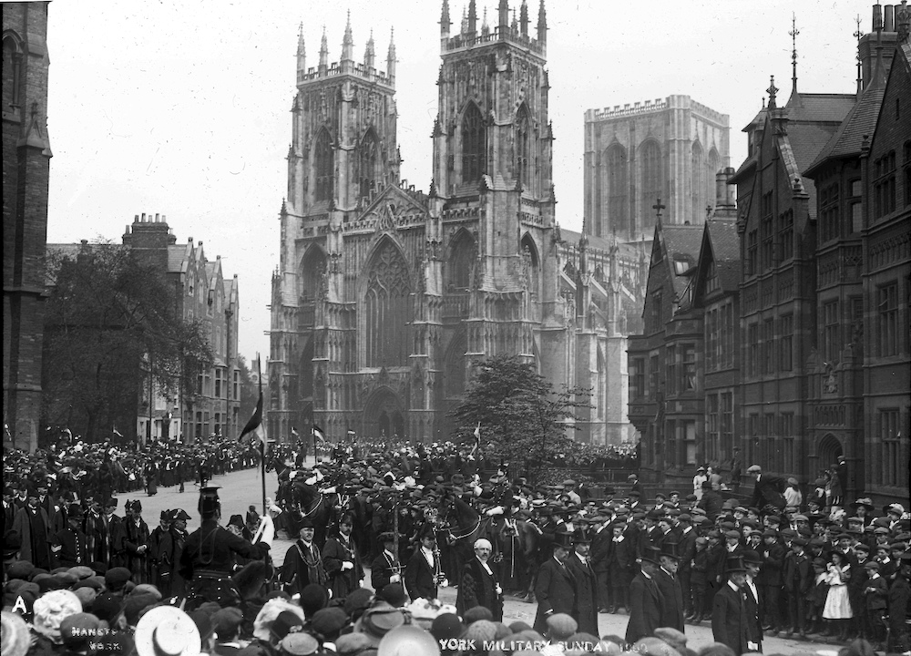
Military Sunday, a late nineteenth-century institution which lasted into the 1930s (early twentieth century photograph). Courtesy of YAYAS Evelyn Collection; not to reproduced without written permission (see link in bibliography).
The street was designed to give an open view of the Minster for those coming from the direction of the railway station (York Herald, 11 February 1860: 8). In the same article, the name of "Duncombe Street" is suggested, in honour of the Dean who had "so handsomely subscribed" £1000 to the scheme. It soon became "Duncombe Place," a more gracious title, indicating its spaciousness compared to most of York at the time (and now).

Looking into St Leonard's place, with Red House on the right.
The nearby St Leonard’s Place was an earlier road improvement, and is more harmonious because of the white curving terrace (1830s) and the white De Grey Rooms (1840s), but it was still a composition built up over many decades, with Exhibition Square and the Art Gallery (1879) and changes at the Theatre Royal (1877-9). There was no grand civic plan beyond making the road, so the "new" York continued to be a medley, like the old one.
New buildings on the south-east side of Duncombe Place
Although the road itself was planned, buildings fronting it were individually conceived and arrived erratically. The width of Duncombe Place had been obtained by demolishing all existing premises on the south-east side of Little Blake Street: these were replaced not by houses or trading outlets, but a wider street with lawns. It was some time before buildings filled the south-east side of the Place behind the lawns: these were the Masonic Hall (1862-63), the Probate Office (1885); and the Dispensary (1897-8). The green space at the north end, opposite nos. 1-3 and nearest the Minster, became the location of the Boer War Memorial.
Gradual loss of the open view of the Minster

Left to right: (a) View from outside the houses built (1851) by Atkinson brothers at nos. 2 and 4, Museum Street. (b) View from St Leonard’s Place junction, with the Red House and the Dispensary.


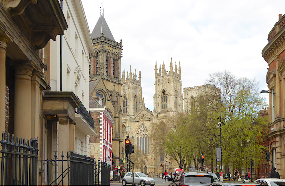
Left: View with St Wilfrid’s, the Dean Court Hotel, the lawns and trees and the former Probate Office and Dispensary. Right: The north-west side of Duncombe Place from Blake Street.
The growth of the trees, mostly limes, and the tower of the new St Wilfrid’s rising close to the pavement, tend to close up the view, especially in the summer.
Related Material
- York Minster
- Boer War Memorial
- Houses at 2-4 Museum Street
- The Dispensary
- York Lodge No. 236 (The Masonic Hall)
- (Former) Probate Office
Bibliography
Fawcett, B. "St Leonard’s Place: Its Development and Buildings." York Historian 26 (2009).
Pevsner, Nikolaus, and David Neave. Yorkshire: York and the East Riding. New Haven and London: Yale University Press, 2002.
York Herald. 11 February 1860: 8.
Created 6 June 2020