In transcribing the following passage from Smith’s text, I have begun with the rough OCR material provided by the Internet Archive and then collated it with the Internet Archive’s page images. If you spot any errors, please notify the webmaster. — George P. Landow
Explanation of the Subject of Strata, and of the Colours by which They Are Represented on the Map
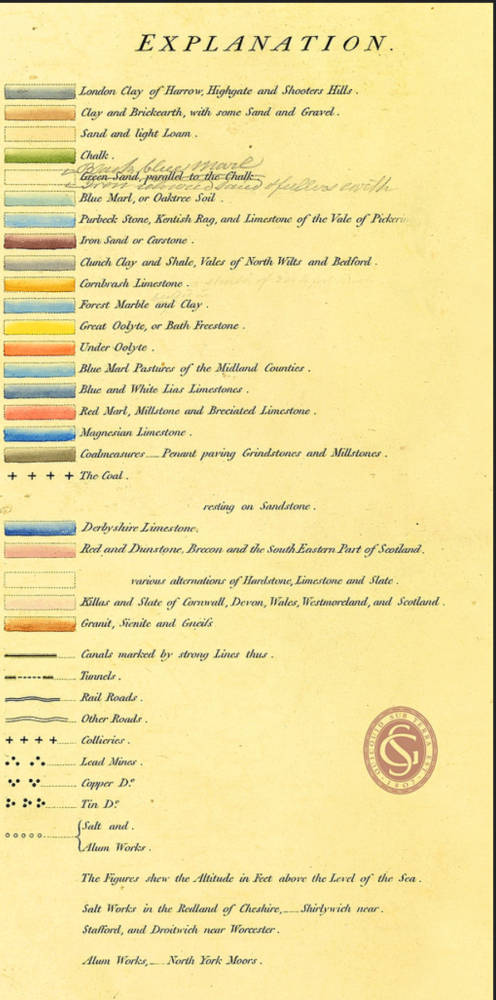
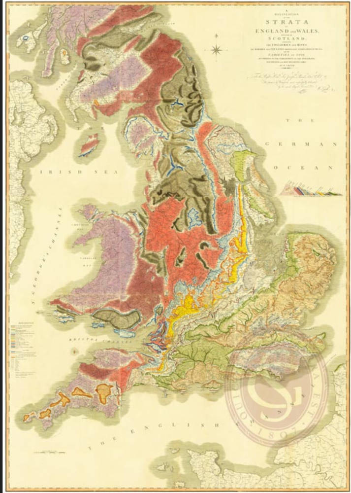
THE courses of the strata, or the length and breadth of surface occupied by each as they rise successively from the level of the sea on the eastern to the western side of the island, are represented by colours.


The color-coded map of geological strata and its key from Smith’s Memoir. Images from the Royal Geological Society’s Flickr account. [Click on images to enlarge them.]
The edges of the strata, which may all be crossed in a journey from east to west, are called their outcrops; and the under edge of every stratum, being the top of the next, and that being generally the best defined, is represented by the fullest part of each colour.
It is thus readily shown that the most general course of the strata is from south-west to north-east, and, in some parts, nearly north and south; while, in the southern parts of the kingdom, many of their terminations have a contrary direction.
The colours, though brighter than those they represent, are in some degree assimilated to the colour of each stratum, except the chalk, which, being colourless, seems best represented by green, strong colours being necessary, and no stratum of equal extent requiring that colour.
In some cases, where the strata are much alike, as the oolytes, Nos. 7 and 12, they are represented by light and dark yellow.
The strong blue represents the lias limestone, Nos. 15 and 16; and the light blue, the blue marl, No. 14, which lies over it
The black shades represent the coal-measures, or the strata which generally contain coal, more or less valuable, several beds of which are too thin for working. The most productive parts are described by the darker shades, which abound with numerous crosses, the sites of the collieries.
In this mode of representing the strata by colours, various insular or detached parts of the same colour may be observed. Where these occur upon high ground (which will be known by attending to the ramifications of the rivers), they represent insular parts of the samer stratum; but where they occur in low ground (which seldom bajipend but by the side of large rivers) they represent the denudated parts of a stratum, whose regular outcrop may be at a considerable distance.
Instances of the latter occur in the (green) representations of the chalk in Norfolk and Suffolk; and of the former in the (yellow) representations of stone-topped hills in the vale of Gloucester. Smaller isolated parts of some of the colours may be observed, chiefly blue, interspersed in the red and in the purple: the first intended to represent points in the courses of limestone, which alternate with red and dunstone, and the other with the killas, or slate; in some parts of which, points enough are ascertained to give the direction of such courses of limestone; but these and other vacancies may be speedily and correctly made up by several able geologists, who are now indefatigably engaged in the pursuit.
In many cases the edge of one stratum terminating on another is gradual, as not to admit of any distinct or definite, line. On this account, those strata only which are the most strikingly contrasted, are drawn on the map, and the spaces not coloured are supposed to be occupied by those which are intermediate. Thus, the loose stratum of sand which lies over the chalk in the flat lands of Norfolk and Suffolk, is too vaguely defined for accurate delineation; but the clay over it, which is drawn, can be more clearly distinguished. The loam, which is a gradation of sand, will, therefore, be generally found nearer to the clay than to the chalk. [8-9]


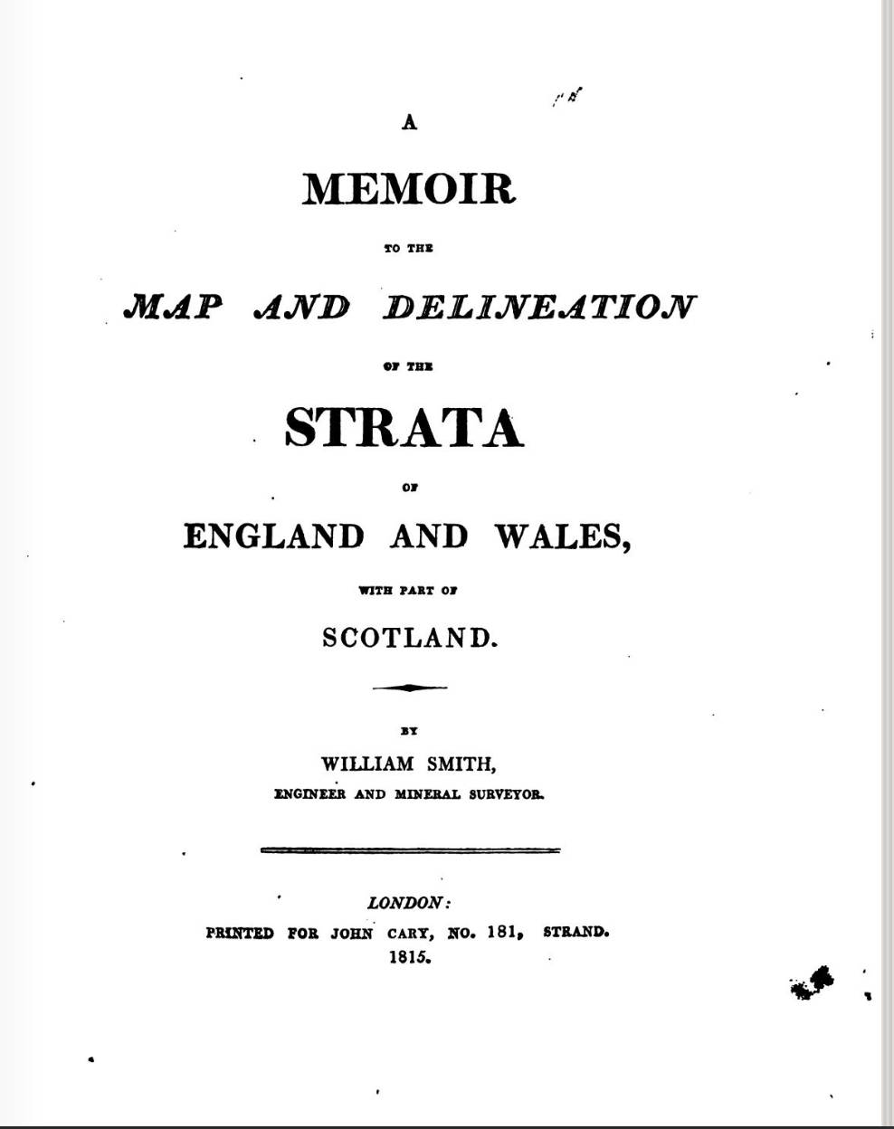
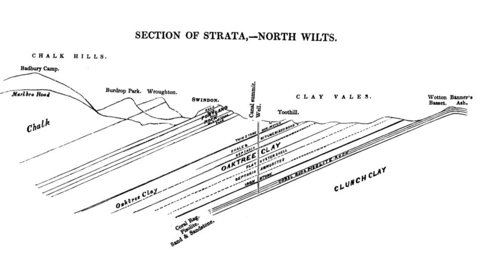
Left: The title-page of Smith’s pioneering work. Right Smith’s diagram of geological strata in North Wiltshire reproduced in Memoirs of William Smith (1844). [Click on images to enlarge them.]
Related material
- The History of the Idea of Geological Strata before William Smith’s Formulation and Map
- William “Strata” Smith (1769-1839): Geology and Coal
- A County-by-County Geological Description of England’s Landscapes.html">
- Soil and Surface Elements in the English Landscape
Bibliography
Philips, John. Memoirs of William Smith, LL.D., Author of the “Map of the Strata and Wales. London: John Murray, 1844.
Smith, William. A Memoir to the Map and Delineation of Strata of England and Wales. London: John Cary, 1815.
Torrens, Hugh. ‘Geological Communication in the Bath area in the last half of the eighteenth century’ in Jordanova, L. J. and R.S. Porter. Images of the Earth Buckinghamshire: England: British Society for the History of Science, 1981.
Winchester, Simon. The Map That Changed The World London: The Viking Press, 2001.
Created 11 September 2018