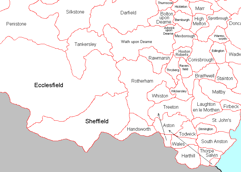
The map shows the ecclesiastical parishes of southern Yorkshire (part of the West Riding) before 1832. Many of these were joined together to form the workhouse Unions.
Produced from an original map by permission of Colin Hinson, (C) from his web page with the generous permission of the author. The map was adapted by Yong Mun Hin and was added by Marjie Bloy Ph.D., Senior Research Fellow, National University of Singapore.
Last modified 1 November 2002