
In transcribing the following paragraphs from the Internet Archive online version of The Imperial Gazetteer’s entry on Trevandrun [more usually spelled as Trivandrum, and now known as Thiruvananthapuram], I have expanded the abbreviations for easier reading and added paragraphing. The title-page bears the date 1856, but internal evidence in various entries makes clear that the text dates from 1851. This discussion of a major city in British India has particular importance because it immediately precedes the 1857 Sepoy Rebellion.— George P. Landow]
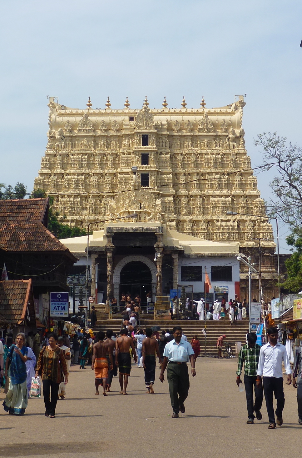
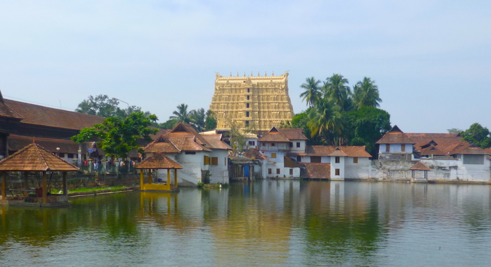
Left: The Sri Padmanabhaswamy Temple at East Fort, with the elaborately carved and richly gilded seven-tier gopuram, rebuilt in 1733, and referred to in the text below as its "celebrated pagoda." On the left can be seen part of the "new [Kuthiramalika] palace," to which reference is also made. Right: The "large reservoir" or tank in front of it. With a good deal more spiritual resonance, the name of this body of water translates as "Lotus Spring."
Trevandrum is a town in Hindoostan and the capitol of the state of it. Travancore, in its southern part, 2 miles from the Indian Ocean, and 32 miles Southeast of Quilon; its latitude (new observatory) is 8˚ 30 N. and longitude 77˚ 12 East. It consists of a quadrangular fort, with walls partly of granite and partly of earth, 1000 yards in length, by 800 in breadth; outside of which on all sides, but chiefly on the North, is an extensive collection of buildings. The fort has five gates, and contains a celebrated pagoda, at which numerous festivals are held, one attended annually by about 60,000 people; a large reservoir, a new palace, and the residences of the chief state-officers, and high court of law: into this citadel, which has a population of about 5000, none but Brahmins or persons of high caste are permitted to enter.
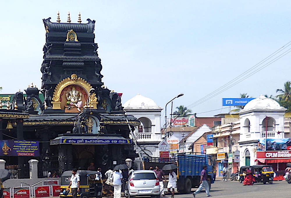
Hindu temple of the elephant god Lord Ganpath, very close to the Sri Padmanabhaswamy Temple but in a traffic-ridden area of East Fort.
In the town outside, many of the dwellings are surrounded by gardens, and the in habitants comprise many descendants of Dutch and Portuguese families, and numerous native Roman Catholics; here are the rajah’s stables, barracks for two battalions of sepoys, European cantonments, and a new Protestant church. About 2 miles East of the fort, on elevated ground, is the British residency, and near it are the observatory, an excellent establishment under British superintendence; an hospital for all castes, and a good public seminary. The population of the town is about 12,000; of immediate district of Trevandrum (1836), 57,012.
Sources of this entry: Madras Almanac, 1840; Report on the Med. Topography of Madras Presidency, I, 72, &c.). [IV, 1,100]
Recent photographs and captions added by Jacqueline Banerjee. You may use the images without prior permission for any scholarly or educational purpose as long as you (1) credit the photographer and (2) link your document to this URL in a web document or cite the Victorian Web in a print one. [Click on the images to enlarge them.]
Bibliography
Blackie, Walker Graham. The Imperial Gazetteer: A General Dictionary of Geography, Physical, Political, Statistical and Descriptive. 4 vols. London: Blackie & Son, 1856. Internet Archive online version of a copy in the University of California Library. Web. 21 November 2018.
Last modified 7 May 2019